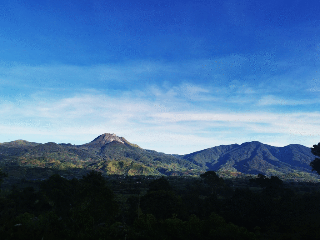

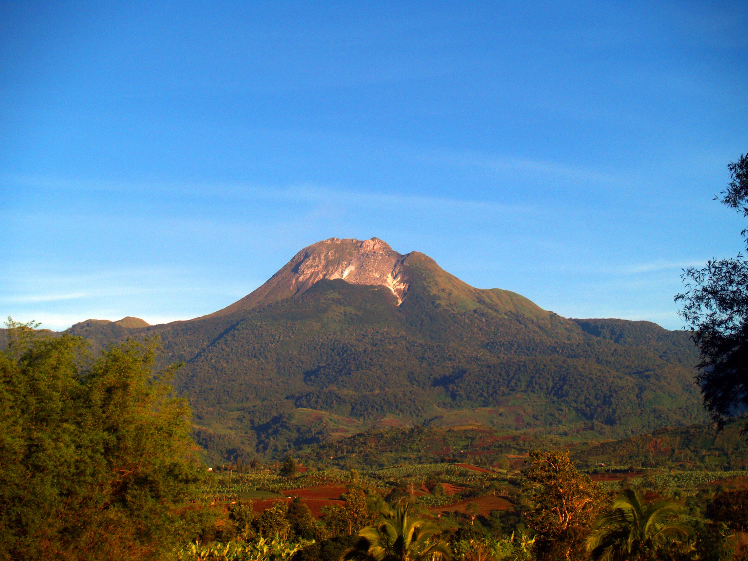
Mount Apo, the Philippines’ highest peak, reaching 2,954 meters above sea level, is a declared Natural Park under Republic Act No. 9237 or the Mount Apo Protected Area Act of 2003. Located in the south-central part of Mindanao, this feature is a stratovolcano classified by PHIVOLCS as a potentially active volcano.
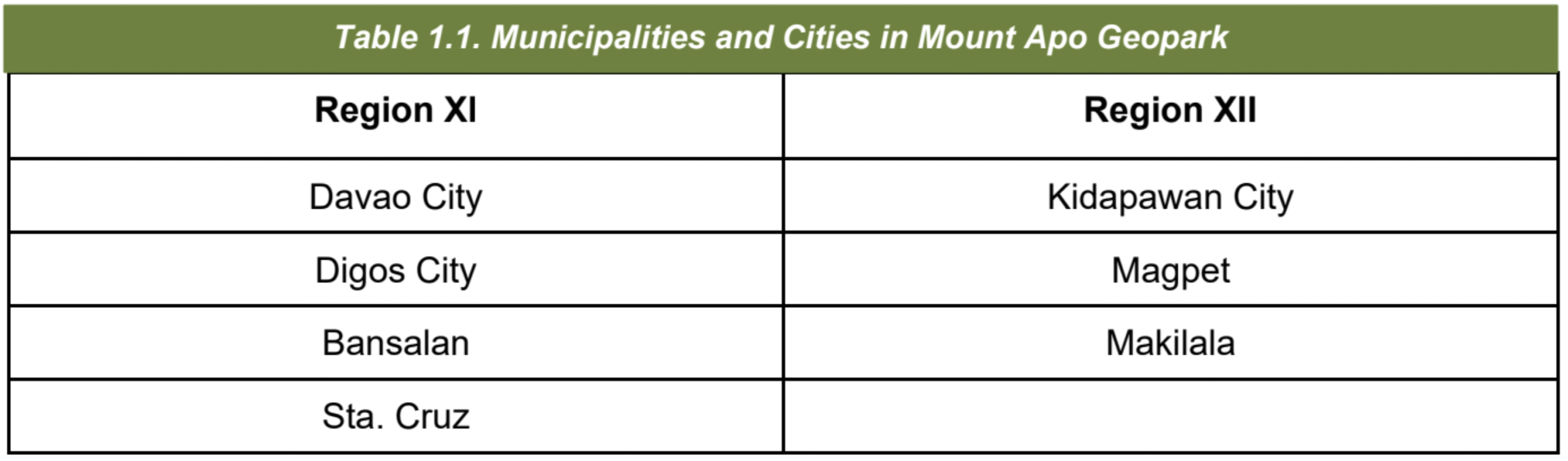
Mount Apo Geopark, also recognized as ASEAN Heritage Park in 1984, through the ASEAN Declaration on Heritage Parks and Reserves, covers Region XI and Region XII, which comprises three (3) cities and four (4) municipalities.
The name “Apo” is derived from Apo Sandawa, the revered ancestral spirit of the Bagobo Tagabawa, Ubu Monuvu, and Bagobo Klata indigenous communities. In their language, Apo means Elder/God, and Sandawa stands for fire. For these groups, the mountain is a physical landmark and a sacred ancestral domain deeply tied to their traditions, rituals, and identity.
The Mount Apo Aspiring UNESCO Global Geopark covers a total area of 640.53 km2 or 64,053 hectares (ha), comprising its component areas of a buffer zone containing 9,095 ha, and a core zone of 54,598 ha known as the protected area, which is also the nominated geopark. The core zone is further divided into two management zones: the Multiple Use Zone (MUZ), spanning 24,239 ha, which promotes sustainable use while addressing community needs, and the Strict Protection Zone (SPZ), encompassing 30,719 ha.
The SPZ is our stronghold, focusing on conservation to safeguard the park’s ecological, geological, and cultural integrity. This expansive distribution highlights Mount Apo Aspiring UNESCO Global Geopark’s strategic role in conserving biodiversity, safeguarding geological features, and protecting cultural heritage across these regions.
Legal Bases:
RA 9237 – Mount Apo Protected Area Act of 2003
RA 7586 – National Integrated Protected Areas System (NIPAS) Act of 1992
RA 11038 – Expanded National Integrated Protected Areas System (E-NIPAS) Act of 2018